User manual
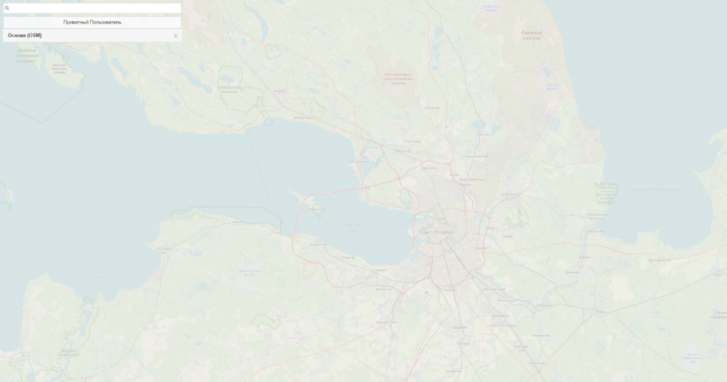
Access the Interface in order to begin to work with the Interface.The main portal window contains a map and a data search string.
To start working with the portal find a layer:
- «Примеры объектов» (задача выявления объектов)
- Objects’ examples (the task of objects identifying).
To find a layer, it is enough to start typing the word:
- «Примеры» (Examples)
- or simply enter an Asterisk character «*» into the search string, and then all layers, published in the system at the moment, will be displayed.
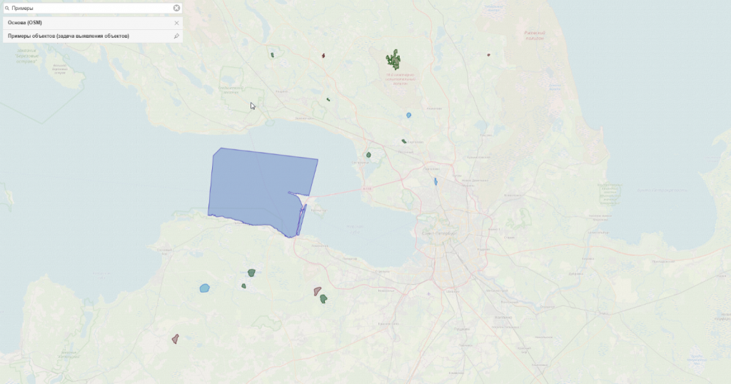
Choose the layer:
- «Примеры объектов (задача выявления объектов)”
- (Objects’ examples (the task of objects identifying),
and this layer will be displayed at the map and will be added to the list of mapping. It is recommended to fix it with the help of the pin tool to the right of the layer’s name. Zoom any displayed object by using the mouse wheel. At this stage it is:
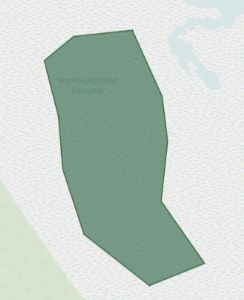
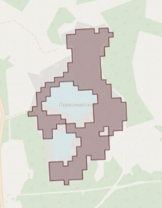
1) Болота (Wetlands)
2) Карьеры (Quarries)
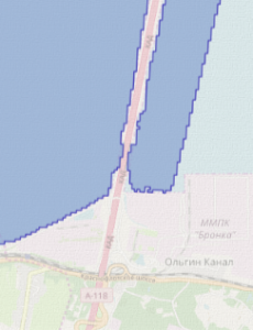
3) Водные поверхности (Water surfaces)
Case example – Wetlands
For example, zoom any of the wetlands. To create a task, it is necessary to define the area of interest. Pressed left mouse button held on any part of the map will create a point and a possibility for a polygon creation. It is necessary to create a polygon which will cover, in whole or in part, the object «Болото» (Wetland), and then take the territory nearby.
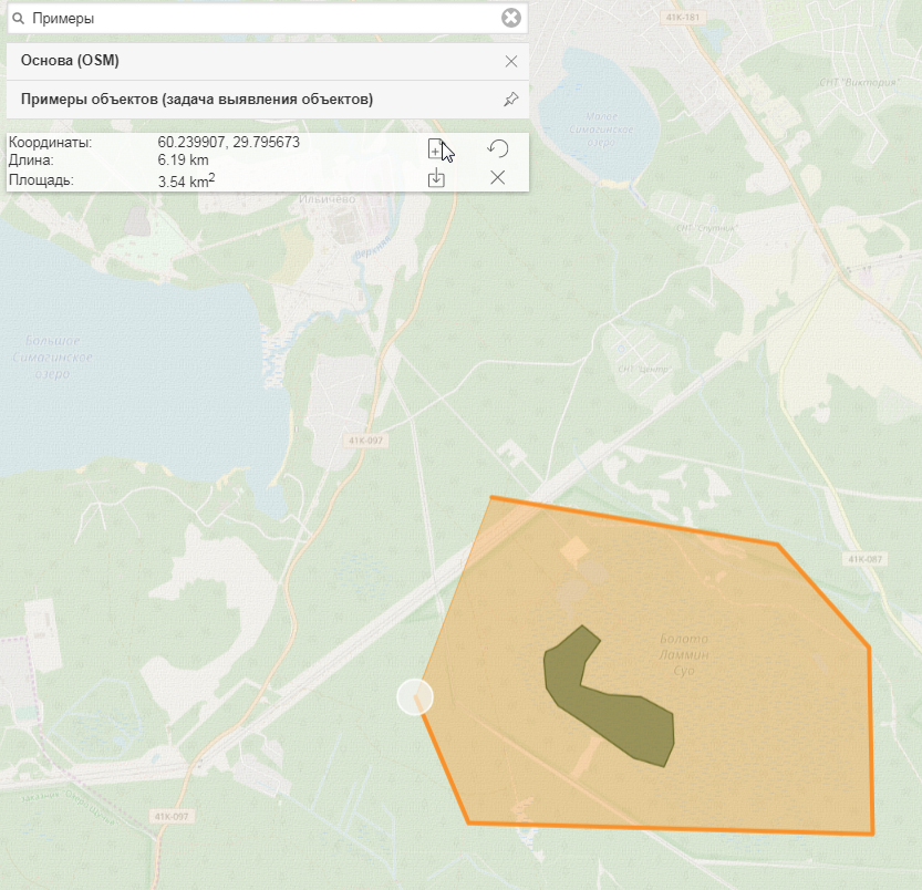
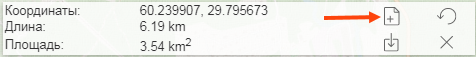
There is no need to finish the drawing. After the necessary polygon creation the information about the created polygon will be displayed leftwards, under the search string and the list of displayed layers. A button showing a paper with a plus will also appear. It is the function of a task creation for the polygon. Press the button and a new page for task selection will be opened.
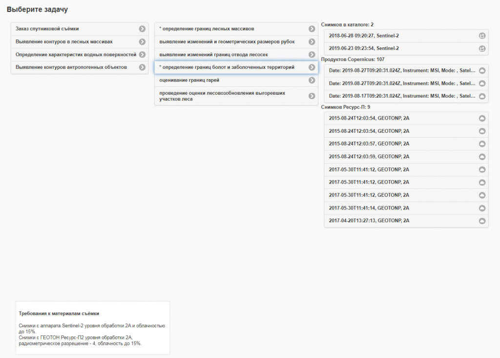
Choose the task:
- «Выявление изменений в лесных массивах — определение границ болот и заболоченных территорий»
- The identification of changes in forest areas— defining the boundaries of swamps and wetlands.
Wait for the list of available images appearance. The appropriate raw data are being sought on the Copernicus resources in addition to the available photos for analysis and calculation performing in the mode “right here and right now”. By clicking at one of the found Copernicus products this product will be downloaded to a user’s device.
NOTE! The authorization with SciHub credentials may be required:
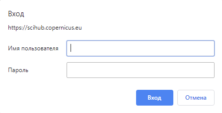
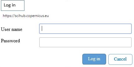
In order to complete a thematic task it is necessary to choose the item “2018-06-28 09:20:27, Sentinel-2 (or 2019). The given image will be used for the task at hand.
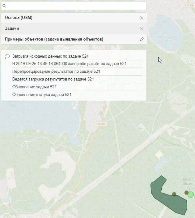
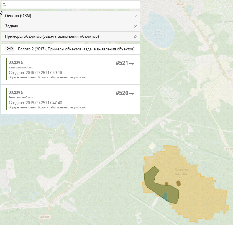
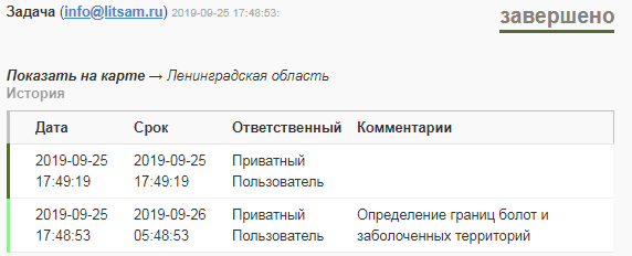
Return to the page with the map and the list of layers. Enter the search string and choose an item «Задачи» (Tasks) in the displayed list. The tasks will be fixed in the layers automatically and a point will appear on the swamp, chosen for study. If the point is light-green it means that data handling is in process. If the point is brown it means that data handling is completed. By clicking the brown point Geometry will appear showing the processing result as well as task information.
By analogy with swamps there are other tasks available for the work:
The changes identification of forest areas: defining the boundaries of forest areas («Выявление изменений в лесных массивах — определение границ лесных массивов»).
The changes identification of water surfaces characteristics: defining the boundaries of water bodies («Выявление изменений характеристик водных поверхностей — определение границ водных объектов»).
The changes identification of water surfaces characteristics: identifying the contaminated sites of coastal areas («Выявление изменений характеристик водных поверхностей — выявление участков загрязнения прибрежных акваторий»).
The changes identification of anthropogenic contours: defining the boundaries of quarries («Выявление изменений контуров антропогенных объектов — определение границ карьеров»).
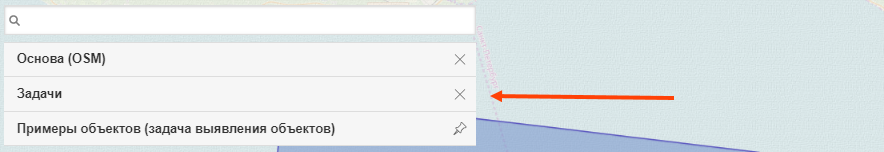
All obtained results will be available and it is possible to review them by clicking on the layer «Задачи» (Tasks), which is fixed in the list of layers.
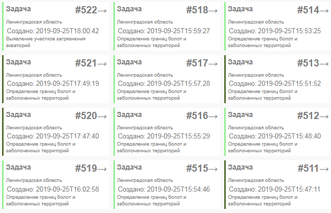
Tasks are displayed in the form of “cards”. By clicking any of the cards an expanded version will be opened. This version contains task status, history of its changes and possibility to show it on the map.
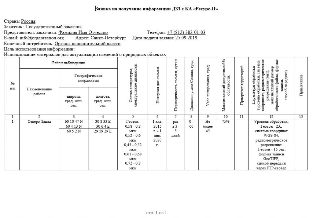
The layer «Каталог ДЗЗ» (Earth remote sensing) is available for user if it is necessary to perform a search for space survey made by Russian spacecraft.
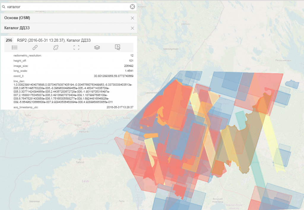
It is necessary to highlight the area of interest in order to search for the data, existing in the catalogue, about a specific territory with set parameters and make an order.
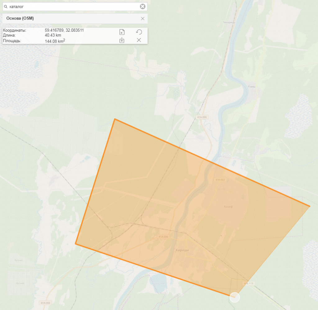
Then, move to tasks selection, choose the menu item «Заказ спутниковой съёмки» (The order of satellite survey) and fill in the form according to survey materials requirements.
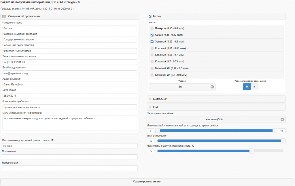
By clicking the button «Сформировать заявку» (Create an application) a user gets the search results made on the basis of all archival data with the possibility of space image preview.
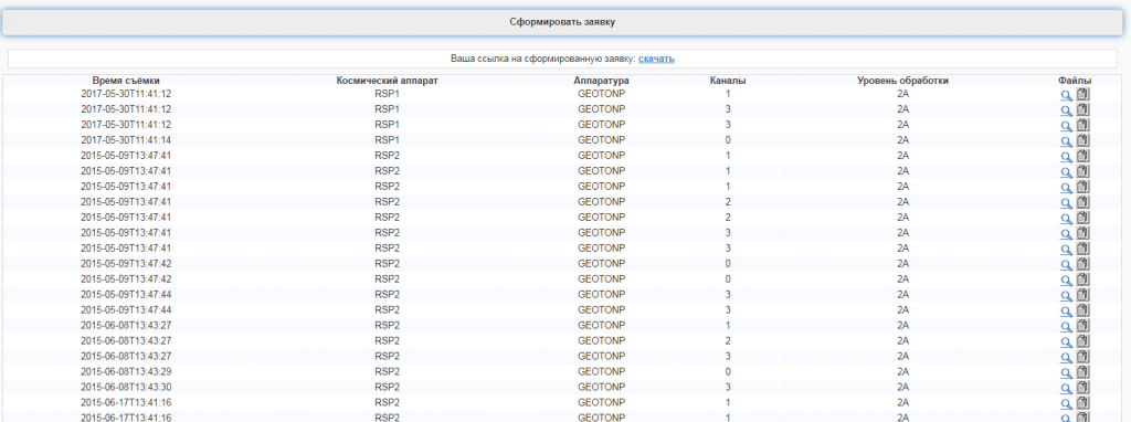
By clicking the button «Скачать» (Download) an application form appears. A user may apply for carrying of a space survey or for receiving historical data.