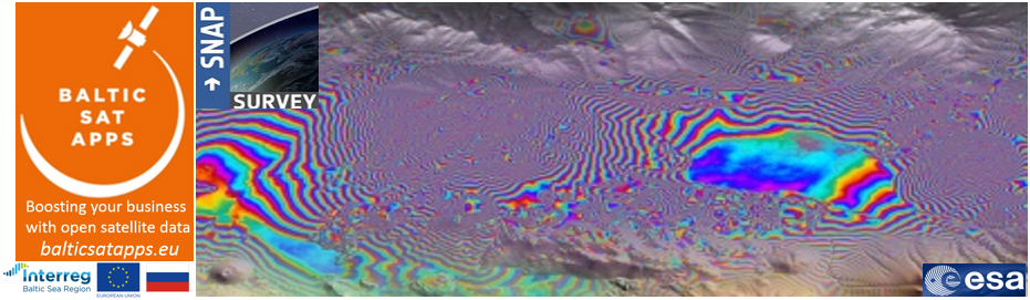
Training on Copernicus data processing: Introduction to SAR images (Sentinel 1) analysis in Sentinel Application Platform (SNAP Software)
As part of the strategy of boosting Copernicus open satellite data use, training in use of open satellite data is being provided by the BalticSatApps project partners, University of Turku and Finnish Meteorological Institute, for students and developers, in Finland and other countries.
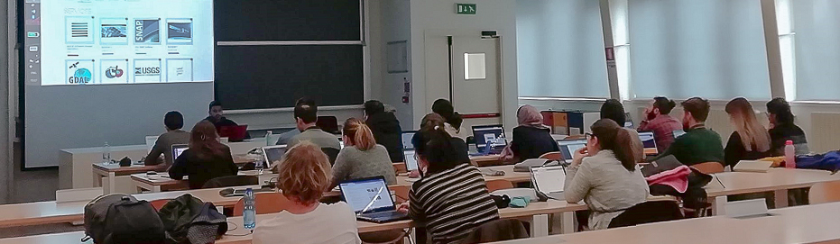
For example, a short training course in Synthetic Aperture Radar (SAR) data analysis using Sentinel Application Platform (SNAP) integrated to the PhD course, entitled, “ Remote Sensing and It’s applications in Cryospheric sciences” has been given at the Polytechnic University of Milan (Italy) on 6–8 February, 2019. Twenty doctoral students, from water science and engineering and geomatics, participated to the training.
The training provided introduction to Copernicus data access, basic SAR data pre-processing, time series analysis of SAR data for environmental monitoring, and interferometry analysis of SAR data. Practical examples have been utilized in the training such as glacier monitoring, natural disaster mapping such as flooding and land subsidence/landslide detection. These phenomena are becoming a pronounce problem under climate change, and Copernicus data is an important information source for disaster assessment and planning prevention strategy.
Further training events using several types of Earth observation data, such as Sentinel 1, Sentinel 2, Sentinel 3 and others sensors, seminars and intensive courses will be planned and organized in Finland and other BalticSatApps project partner countries like Sweden, Estonia, Poland and Russia in collaboration with Copernicus like Copernicus User Forums, Relays and Academy.