BalticSatApps was partly interacting with OceanHack 2019 winning team led by Junior Research Fellow of Tartu Observatory
The winning team IceWise plans to combine Sentinel-1 data with ice thickness measurements made by citizens. Part of the app would be a map where layers with different data could be displayed on. For example, the map could show if there is any ice cover as well as the type of the ice. The satellite pictures of Sentinel-1 enable to assess that.
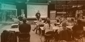
Half of the team already met in September at the Advanced Training School on Remote Sensing/EO organized by the University of Tartu for the first time, and BalticSatApps was among the multiple supporters. Read a news by University of Tartu, what the winning solution was about, and what kind of benefits the team leader Kristi Uudeberg found in participating different information, training and ideation events like hackathons.
The Copernicus Marine Service (CMEMS) is one of the six currently provided services under the Copernicus programme. The Oceanhack 2019 hackathon was organised in Tallinn, Estonia on 22–24 November 2019, supported as well by EUMETSAT, the Copernicus Marine Service and the Estonian Environment Agency.
The challenge was to create solutions to problems that currently affect the Baltic Sea, and beyond, and help people in their daily lives in this region. To solve this challenge participants were encouraged to use the wealth of newly-available Copernicus marine data which is all open access and ready for use. Explore the Copernicus OceanHack 2019.