Experiences from Estonia: How to make best possible use of data of Sentinel satellites and Copernicus programme?
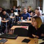
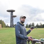
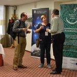
At the international remote sensing training school in Kubija, Võru County, young researchers and renowned experts from around the world met to discuss making the life of the Baltic Sea area better by using remote sensing. The University of Tartu among with the Earth science network Baltic Earth held a Remote Sensing Advanced Training School “Applications of Remote Sensing in the Baltic Sea region” on September 15–20, 2019 in Võru County at the Kubija SPA center. 33 students and junior research fellows from the field of natural sciences took part in the training school. Lectures were given and practical works supervised by internationally recognized experts and researchers.
Remote sensing is the method of using satellites to observe the processes on Earth. It has developed fast, hand in hand with the development of space technology, and has grown to be an important science development and business area by now. In Estonia, remote sensing has set to be one of the priorities in developing the space industry with the approval of both the Space Policy Working Group and the Estonian Space Council.
The potential of Estonian research and development centres and enterprises covers all of the main fields connected to environment as well as the most important applications for Estonia regarding the research and monitoring of waterbodies, forestry, agriculture and atmosphere.
ESTHub stores satellite data about areas important to us
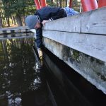
Estonia has its own strengths in the field of remote sensing. Above all, we have been in the forefront in the research of the water quality of lakes and the Baltic Sea as well as waves, sea wind and ice cover. Among others, these topics were further discussed at the training school by the UT Tartu Observatory’s Director Anu Reinart and Associate Professor Krista Alikas. In the recent years, agricultural research using satellite data has also taken some major steps. For example, the observatory’s Research Fellow Kaupo Voormansik and his enterprise KappaZeta is developing a system which detects all mowing on agricultural grasslands in Estonia together with the Estonian Agricultural Registers.
The application stores its data in ESTHub, the Estonian Land Board’s national mirror site for satellite data. ESTHub was launched this year and was introduced at the training school. The ESTHUb was created to make the best possible use of the data of the Sentinel satellites that have been sent on orbit within the Copernicus programme. In the mirror site, mission data of both Estonia and other areas of interest are stored. The datasets are freely available and downloadable for anyone, but right now, the data processing service within ESTHub is only meant to be used by the government institutions and enterprises providing services for the institutions.
Satellites help detect fires and climate changes
Over 20 renowned remote sensing experts from West and East were giving lectures and practical workshops in the training school. Their aim was to share their knowledge with the 33 PhD and master’s students and young researchers from 14 different universities from the Baltic Sea region.
To bring new competences to the training school, world-known remote sensing experts were invited to attend. One of the visitors of the training school, dr Ivan Csiszar from the National Oceanic and Atmospheric Administration (NOAA) of USA, has been researching the atmosphere and Earth with satellites for about 30 years now.
Satellite pictures also help to prove climate change. Among others, Kuo-Hsin Tseng from the National Central University of Taiwan attended the training school. In his studies, climate warming is expressed as the increase of waterbodies and water level change. This is caused by the melting of glaciers. When the increase of waterbodies can be seen on satellite pictures, then to monitor the water level, satellite altimetry is used.
Karin Pai, Project Manager, Tartu Observatory, University of Tartu
Organizers and more information
Piia Post, piia.post@ut.ee, UT Institute of Physics
Karin Pai, Karin.pai@ut.ee, UT Tartu Observatory
The training school was organized by the UT Tartu Observatory and the Institute of Physics and the Baltic Earth, which is a network of Earth scientists, as well as the Estonian University of Life Sciences Institute of Forestry and Rural Engineering and TalTech Department of Marine Systems.
The training school was sponsored by the Doctoral School of Earth Sciences and Ecology and funded by the projects BalticSatApps, KOMEET, Value-Chain Based Bio-Economy and RITA KAUGSEIRE.